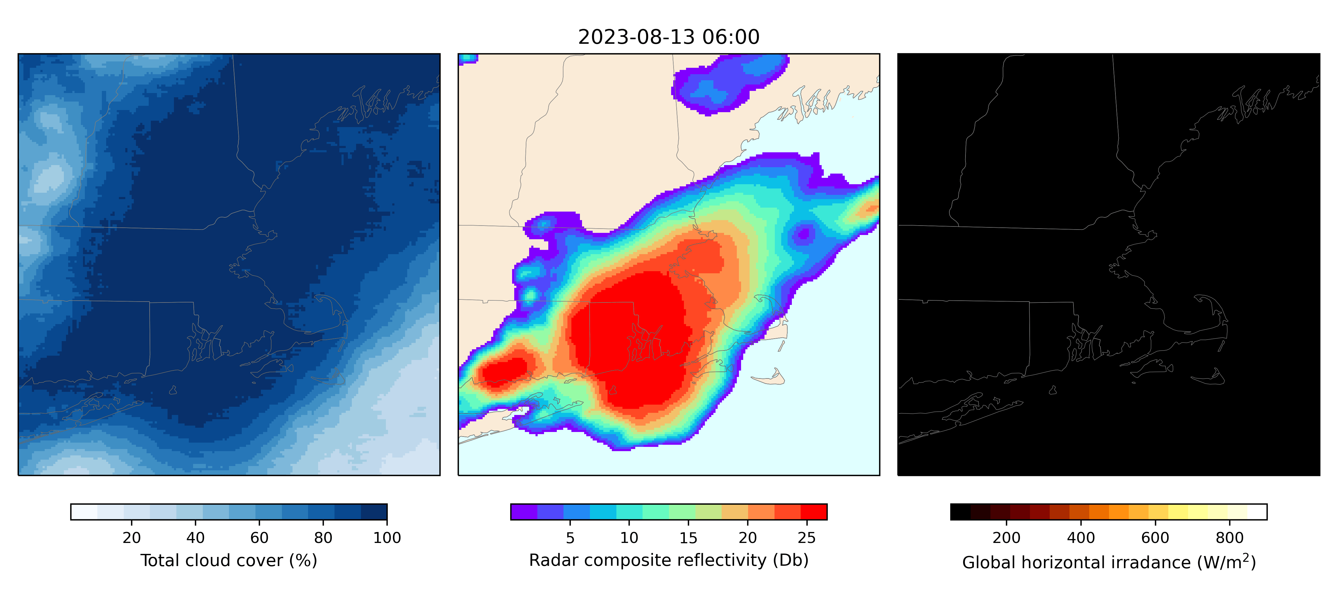
This summer’s severe precipitation events, wildfires, and persistent heatwaves have elevated weather to a new level of attention. Zeus AI’s recently released assimilation and forecasting system, LENS, has been tracking weather patterns in real time. In this visualization, the fraction of the sky covered by clouds is depicted alongside synthetic radar reflectivity and surface solar irradiance.
Clouds can significantly attenuate the amount of solar radiation reaching the earth’s surface by scattering and absorbing sunlight. The relatively coarse resolution of weather models, especially when compared against the fine scales of cloud microphysics, poses a significant challenge to achieving accurate simulations of cloud formation and progression.
The integration of real-time imagery from geostationary satellites, such as GOES-16, keeps the LENS system in sync with the actual positions, movement, and opacity of clouds. By integrating real-time multispectral imagery from geostationary satellites into our novel system for data assimilation, we can continuously monitor the state of the atmosphere. The enables us to re-initialize our forecasting model with the latest conditions many times per hour.
Better cloud representation holds promise to improve forecasts of solar irradiance, the most critical variable for predicting of solar power generation. Solar power accounts for a significant and growing proportion of America’s energy supply.
Radar composite reflectivity helps meteorologists to track and predict high-impact weather. Radar reflectivity is related to the intensity of precipitation, with the amount and type of precipitation influencing the amount of scattered energy that returns to a radar antenna.
Radar stations can cost over $1M to build and are expensive to maintain. They require a continuous power supply, data processing, and regular maintenance. In addition, radar systems are vulnerable to outages during severe weather events, such lightning strikes or strong winds.
A lack of radar coverage results in reduced performance of weather forecasts, which in turn can lead to more devastating impacts of severe weather. Here, satellite data can help to fill gaps. Satellite-derived synthetic radar is helpful for managing hydrometeorological risks in regions where direct radar coverage is not adequate or available.
Amid ever more sophisticated technology, our mission remains simple: to provide timelier and more accurate weather forecasts where they matter most – mitigating severe weather impacts and curbing greenhouse gas emissions. If you share these goals, please subscribe to our upcoming newsletter to stay in touch.